Hazard & Impact Assessment
From Earth Observation to Socioeconomic Risk Indicators
Understanding medicane-related risks improves our knowledge of their impacts and helps enhance the resilience and preparedness of communities across the Mediterranean region. Phase 2 of the MEDICANES project addresses this challenge head-on by developing an integrated framework that connects EO-based medicane observations to quantitative, spatially explicit impact and risk indicators. This new work builds on the achievements of the core project while extending its scope through the integration of social and economic assets. In this way, it supports the transition from hazard-based to impact-based forecasting — a paradigm shift promoted by the World Meteorological Organization (WMO) that shifts the focus of predictions from what the weather will be to what the weather will do.
An Integrated Workflow: From EO Data to Risk Information
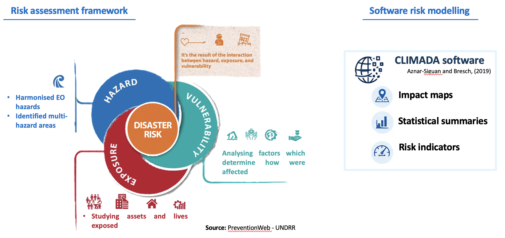
Within the MEDICANES project, we follow a systematic framework that transforms raw satellite data into actionable risk information, with each step building on the previous one. This framework begins with the collection and processing of Earth Observation (EO) data, which are used to detect, monitor and characterise medicane-related hazards. The resulting hazard information is then combined with high-resolution socioeconomic datasets to identify exposed assets and populations and characterise their vulnerability, thereby determining where medicane-related hazards may lead, to significant consequences. In this way, the workflow connects physical hazard characterisation with spatially explicit impact and risk indicators, providing information that can support preparedness, resilience planning and the transition towards impact-based forecasting.

EO-Based Hazard Detection and Characterisation
The first pillar of the work builds a harmonised, multi-source EO dataset repository, integrating data from Sentinel-1 and Sentinel-2, the Copernicus Emergency Management Service (EMS), the atmospheric and ocean data reanalysis, the Copernicus Marine Environment Monitoring Service (CMEMS), and modelling high-resolution products . These datasets feed into:
Socioeconomic Exposure and Vulnerability
EO-derived hazard footprints are then combined with high-resolution socioeconomic datasets to understand who and what is at risk.
Impact Quantification and Multi-Hazard Risk Analysis
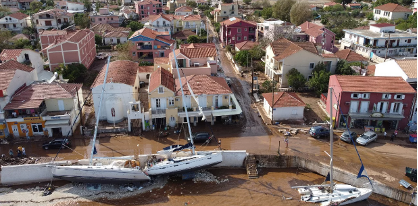
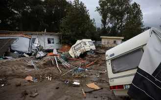
EO-derived hazard footprints developed in this work are then combined with high-resolution socioeconomic exposure and vulnerability datasets outputs. This will allow to develop geospatial impact maps, statistical summaries, and key risk indicators for understanding the risk of these extreme cyclonic systems in the Mediterranean basin, translating hazard intensity into expected damage or impact.
This proposed risk assessment workflow will be integrated into CLIMADA, which provides impact modelling for risk assessment. The diagram below summarises how the three components described above — hazard characterisation, exposure and vulnerability assessment, and impact quantification — are combined into a coherent risk assessment framework, with CLIMADA acting as the central modelling engine.